Coveted by the Israelis, the vast green area between Jerusalem and Bethlehem, which belongs to the Cremisan Monastery, is considered “contested land.”
After passing the historic, still-inhabited al-Najjar family home in Beit Jala, we see a large concrete block on the road, marking the beginning of “Area C.” It feels like a bad omen. This is one year before October 7. I was on a walk with two friends, Madeline and Samar, to the Cremisan Monastery, which sits atop a hill in Beit Jala — Aramaic for “green carpet” — five miles north of Bethlehem. We made our way down a narrow dirt road that winds between a few inhabited houses and the Salesian Sisters Convent and School, and alongside an ancient olive grove laden with fruit. Our reward: stunning views of the northern and western Jerusalem Hills. Wadi Ahmad, the dry wadi in the steep valley between us and those hills, flows eastward through the hilly terrain of Bethlehem and Beit Jala to lower ground, ending near Rachel’s Tomb on Bethlehem’s northern edge.
Over a decade ago, Israeli occupation authorities illegally annexed and partially cordoned off this whole area — Palestinian land within the Beit Jala town boundaries — to Jerusalem. Today, this area, which includes the neighborhood of Bir Ouna, is a grey zone with limited access. This lack of clarity is especially problematic as Bir Ouna is a significant landmark for the Christian residents of Beit Jala, who believe the Virgin Mary appeared there. When Israeli authorities seize more land, as is planned, the life of Beit Jala’s Palestinian residents will irrevocably change yet again.
As we walked on that sunny and peaceful October afternoon, my companions recalled stories their grandparents had told, such as how hyenas used to roam the wadi decades earlier. I remember leaning over a low stone wall and peering down at the old, twisting road at the bottom of the fertile Wadi Ahmad Valley. Samar sighed. “We used to come here on religious holidays in the spring and summer months.”
Madeline continued the thought. “This area was Beit Jala’s favorite playground for families only four decades ago. We often came for picnics. While our parents picked luscious fruit, we, the children, roamed and fearlessly explored the hills. Now it’s off limits.” She continued. “Almost every single Bajalli over forty has fond memories of this beautiful valley.” Samar agreed, before adding with bitter sarcasm: “And they say that this is ‘contested’ land!”
In the past, Bajjalis, often women, had a daily routine of drawing water from the Bir Ouna well in Wadi Ahmad. They would carry a 20-liter tanake or jerrycan on their heads or shoulders as they climbed up the steep hill to fetch water for their families. Before homes were connected to water and sanitation systems, women also did their weekly laundry at the Bir Ouna well.
Samar and I recently returned to the monastery grounds, almost three years exactly after that stroll with her and Madeline. Not much had changed, in appearance at least. Most of Bethlehem’s Palestinian residents, and Palestinians across the Occupied West Bank, remain deeply connected to their land, its heritage, and their inherited memories. Despite increasing Israeli political and economic repression, land theft, economic squeezing, and restrictions on free movement, Palestinians continue to resist, make a living, and raise their families in hope of a better future. We still hold engagement parties and celebrate weddings, some of which are held on the grounds of the Cremisan Monastery. This resilience is Palestinian sumūd. But we all fear the consequences of what’s coming next.

The western “suburbs” of Jerusalem
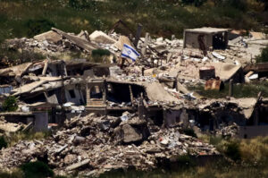
On the other side of Wadi Ahmad, clearly visible on the opposing hill, are numerous Israeli residential areas that were built on Palestinian land. These “suburbs,” or more precisely settlements, in the western hills of Jerusalem, consist mainly of high-rises. The largest is Gilo, a stone’s throw across the valley. It was constructed on land appropriated from the villages of Sharafat and Slaieb, after they were annexed following the 1967 war. Many of the homes and farms in these villages were destroyed to make way for this satellite “suburb.” Today, Gilo is overwhelmingly Jewish-Israeli (approximately 30,000 residents).
Further north of Gilo lies Al-Malha, formally Al-Maliha, another Palestinian village whose residents were ethnically cleansed during the 1948 Nakba. Many Malhi refugees now live in an area called Jabal Al-Mawaleh (Mountain of the Malhis), in Bethlehem. Their former land is the current site of an upscale Israeli neighborhood and one of Jerusalem’s largest shopping malls, the Kanyon Hazahav (Grand Canyon). The few remaining grand Palestinian houses are usually eagerly bought up and inhabited by wealthy Israeli residents.![]()
The monastery grounds
To reach the Cremisan Monastery, you must pass through well-guarded metal gates, after being screened by the guard on duty. One can’t help but feel a profound sense of awe upon entering the monastery grounds. The beautiful Italianate buildings were constructed in 1885 on the remains of an ancient Byzantine monastery that dates back to the seventh century. Besides its religious significance, the Cremisan Monastery is cherished by the local community for its stunning agricultural landscape, which boasts olive trees and carefully arranged terraced vineyards that slope down into the Wadi Ahmad Valley. For thousands of years, local farmers have maximized cultivation and available water by terracing the hills. The monastery grounds also host a youth cultural center and a large children’s playground, which is unusual — there are hardly any public playgrounds in the nearby Palestinian cities. Even the air is cleaner here, as compared to that in the traffic-heavy Bethlehem Triangle: the three cities of Bethlehem, Beit Jala, and Beit Sahur located on lower ground.
Once atop Cremisan Hill, you can see the neighboring village of Al-Walaja, which can be accessed via the monastery on foot. For the past ten years, however, Israeli authorities have blocked vehicle access. Walajis now have to use alternative roads through Israeli-annexed territory to access their village by car.

West Jerusalem, too, is visible: from this vantage point, you can see how close those hills really are. Al Quds, the Arabic name for Jerusalem, holds profound religious and national importance for all Palestinians, regardless of their religion; it is the beating heart of Palestine. In recent years, Israeli restrictions have made it harder for most Palestinians to visit their Holy City. This small glimpse of Palestine’s most sacred city is always an emotional experience, stirring a complex mix of joy and sadness.
Scattered along the Cremisan Hill slopes are a few old houses still inhabited by Palestinian families. Some stay there year-round, while others visit only in the summer or occasionally; most of the owners now reside in Beit Jala. Israeli restrictions and sealed areas make accessing the region difficult.
Settlers and the state of Israel have been engaged in a continuous battle to change the original face of the land, in a relentless pursuit to supplant Palestine’s rugged and arid Mediterranean terrain with an imagined European-like landscape.
As I walked, I couldn’t help but think back to my previous visit to Cremisan, accompanied by my dear friends, at a time that has since tragically become defined by a hyphen: pre-October 7. Samar, Madeline and I had eventually reached a small forest with dense vegetation. The trees here are indigenous — including a local oak species called ballut and a native variety of hawthorn known as za’rur, among other wild shrubs — and produce fruits traditionally eaten by Palestinians. Seeing this Palestinian forest was already rare, but then we spotted something even rarer: women and children enjoying a picnic under the trees. In a common gesture of Arab hospitality, the women invited us to join them. Samar told me that, during the summer, fruit pickers often offer fruit to people on the grounds, especially those who arrive early in the morning.
Sadly, a picnic has become a rare sight nowadays; Palestinians can hardly find places to gather outdoors. All the open spaces outside our West Bank towns and villages have either been confiscated or placed off-limits by the Israeli authorities, who are intent on building more settlements (and roads leading to these settlements). Jewish settlers frequently uproot old olive trees and other native trees that once dominated the landscape and replace them with different species of pine. They and the state of Israel have been engaged in a continuous battle to change the original face of the land, in a relentless pursuit to supplant Palestine’s rugged and arid Mediterranean terrain with an imagined European-like landscape.
From our vantage point just behind Cremisan Hill, we could see a strategically located Israeli settlement: Har Gilo, on Beit Jala’s highest hill, called “Ras Beit Jala.” This outpost was established shortly after the Israeli occupation of the West Bank in 1967 on land belonging to the residents of Beit Jala and Al-Walaja. With its population of about 2,000, it looms ominously close, just behind the monastery grounds but not directly visible. The residents of Al-Walaja, however, situated on even higher ground, observe the steadily expanding hilltop settlement with growing apprehension.
Keep going, and you’ll stumble upon a winery, where Italian monks have been producing some of Palestine’s best white and red wines since 1885; the path then ascends towards Al-Walaja. The Jerusalem Municipality illegally annexed this village’s land, yet its residents remain under the jurisdiction of the Palestinian National Authority (PNA). This bizarre arrangement illustrates underlying Israeli intent: to acquire more Palestinian land, but not its indigenous inhabitants. Such a policy could explain why strong opposition to Israeli apartheid originated specifically from this village, namely in the figure of the environmental activist Basel Al-Araj (1984–2017), who inspired many with his nonviolent resistance.![]()
The encroachment continues
Still today, the standalone sections of a wall mar the otherwise serene walk to the monastery. They may one day become part of the existing Segregation Wall, which has been under construction since 2002. It’s hard not to feel outrage at such a sight. Namely at the increasingly blatant disrespect for the land and its Palestinian inhabitants, who have lived here for thousands of years. Sadness, too, at one of its many consequences — the “bleeding of Beit Jala,” to borrow Madeline’s words. Together with Samar, we have eight children between us, only three of whom remain in Beit Jala. Some have immigrated to Canada, others to the UK. In the summer, or over Christmas, the remainder of our brood try their best to visit us during their vacations. Families are the backbone of Palestinian society, and the separation of families takes a toll on all of us, financially, socially, and emotionally.
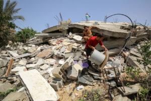
A little over a decade ago, construction for Highway 60 tore through Beit Jala like a juggernaut. Repeated explosions shook the ground, weakening the foundations of many homes. Today, a tunnel bridge (jisr al-nafaq), hangs in close proximity, directly outside many people’s windows and balconies; settlers peer in as they drive past, invading Palestinian privacy. The concave walls on both sides of the bridge are lined with ugly rows of barbed wire and bright spotlights to boost security for settler vehicles. All of these incursions have turned the formerly peaceful town of Beit Jala into something that increasingly feels like a concentration camp.
More ominous, if possible, is a plan for a new settlement east of Jerusalem called E1, which would effectively break up the West Bank into two separate parts, one north and one south of Jerusalem. The E1 settlement, planned to be annexed to the Ma’ale Adumim settlement on the eastern hills of Jerusalem, would also effectively disconnect East Jerusalem from the West Bank. Samar, aware of the plan, which was already in development three years ago, warned us of how travel to Ramallah (our current capital), or Jericho (our gateway to Jordan), would now be through “Israeli-annexed,” not “Israeli-occupied” Palestinian land. Worse, Palestinians would be barred from traveling on normal roads to reach those places; the plan supposedly entails a system of underground tunnels using tax money confiscated from the Palestinian Authority.
“They are stealing our land, chunk by chunk,” she concluded. “The projected E1 settlement would cover a 12-kilometer square area or roughly 3,000 acres that would be built over a Muslim cemetery and a garbage dump.” She repeated the words as though she herself could not quite believe it. “Just imagine, a cemetery!”![]()
More loss to come
Samar was right, it turns out: new expansion plans for Gilo are already underway, according to a report published by the POICA Project on May 12, 2025. The two-pronged expansion envisions establishing a new settlement east of Gilo by constructing 805 new residential units. It also involves building a bus parking lot south of Gilo/north of Bethlehem on land belonging to Bethlehemite families, supposedly to handle “increasing traffic demands.”
If implemented, the plan would effectively isolate Bethlehem from the West Bank, specifically from Jerusalem, thereby severing historic spiritual, cultural, and economic ties between the two sister cities, both of which have been important sites of Christian pilgrimage for over 2,000 years. In the past, it took ten minutes to drive between the two cities. In later years, that same trip became a nightmare, taking hours due to an increasingly complex system of crossings, permits, and the Segregation Wall. Since October 7, 2023, this trip has become virtually impossible for Palestinians.
It has become increasingly clear that with the Israeli land annexation to the west, east, and north of the Bethlehem Triangle, the three cities might become completely choked off and enclosed. For those of us living here, this could mean the three-city complex is erased as an entity. Israeli systematic and unilateral annexation measures, meant to consolidate the total fragmentation of the West Bank’s geography, will make a future Palestinian state untenable.
The Cremisan Monastery’s sprawling grounds stand in the way of a possible planned merger between Har Gilo, located in Beit Jala, and the larger settlement of Gilo on the western outskirts of Jerusalem. If it were to be implemented, the Cremisan Monastery might lose its terraced vineyards and its mini-forest and be reduced to just a few beautiful old Italianate buildings surrounded by a very tall wall.
Samar, Madeline, and I remain friends, still meet for strolls, still share our joys and worries, still continually ask one other, in reference to our beloved monastery — “For how long?”
![]()